Bunker Supply
Reliable, compliant marine fuel delivery tailored to keep your vessel powered and on schedule across Malta’s ports and anchorages.


Reliable Marine Fuel Solutions
With decades of experience in maritime logistics, Carmelo Caruana Company Limited delivers efficient and compliant bunker supply services across Malta’s key anchorages and terminals. We provide marine fuels for all vessel types, ensuring timely delivery with strict adherence to international regulations and safety standards.
Our team manages every aspect of bunker coordination—from scheduling and documentation to liaising with physical suppliers and port authorities—ensuring minimal disruption to vessel operations.
We understand the importance of fuel quality, speed, and operational certainty. That’s why we work only with trusted partners to supply VLSFO, MGO, and other grades, ensuring full traceability and documentation for every transaction.
Full Coordination, 24/7 Support
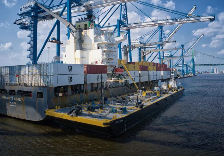
Whether alongside berth or via barge at anchorage, our bunker supply services are designed for maximum flexibility. We arrange:
- Ship-to-ship fuel transfers
- Port-based bunkering operations
- Compliance with IMO 2020 & MARPOL regulations
Every operation is managed with safety at the core, ensuring spill prevention, environmental protection, and seamless communication throughout.
With Carmelo Caruana Company Limited, bunker supply isn’t just a transaction, it is a fully coordinated service that ensures your vessel stays fuelled, compliant, and on schedule.
Trusted Bunker Supply Across Malta
We provide timely, compliant bunker services to keep your vessel running efficiently throughout Malta's ports and anchorages.
Get in TouchWhy Choose Carmelo Caruana
well connected since 1923
100 years of safe, efficient, and cost-effective maritime and shipping services.
Extensive Industry Experience
Carmelo Caruana is recognised across the central Mediterranean and beyond for its long-standing expertise in Ship-to-Ship (STS) Operations, Ship Agency, Freight Forwarding, Free Trade Zone Warehousing, and Oil & Gas Logistics. This reputation is built on consistent delivery of tailored solutions, strong client relationships, and industry-specific knowledge.
Responsive Operations
Our expert teams are available around the clock, to mobilise for emergency port calls, time-critical freight movements, or dynamic STS transfers. From the oil & gas sector to multimodal supply chain, the company's operational readiness ensures requirements are met with precision and agility.
Reliable and Cost-Effective
With decades of practical experience, Carmelo Caruana Company Limited delivers streamlined logistic solutions that minimise delays and optimise budgets, particularly in high-stakes environments such as as STS Operations, project cargo coordination and offshore supply chains.
Safety as a Standard
Safety is integrated into every aspect of operations, from mooring to warehousing. Our mooring masters, vessel agents, and shore-based staff receive regular training and certification, while all equipment is subject to strict maintenance and renewal cycles.
Integrated Logistics Solutions
Clients benefit from a seamless, end-to-end logistics offering across all core services. With a single point of contact for freight forwarding, STS transfers, customs handling in Free Trade Zones, and ship agency support, operations are simplified and costs reduced.
